Friday, August 19, 2011

Quechee Gorge, VT, then Plymouth, MA and Woods Hole, MA

Quechee Gorge
On Sunday (the 14th), we packed up quickly in anticipation of rain, though thankfully, it only drizzled occasionally throughout the day. We headed to Woodstock, Vermont, about 60 or so miles north of Newfane, to meet our friends, Mary and Richard. Along the way, we saw breath-taking views of the Green Mountains on both sides of I-91, but when we passed through Quechee Gorge, we knew we needed to come back to see more.

Quechee Gorge
After lunch with M&R and son, Adam, we trekked around the gorge, taking in the sights from the former railroad bridge (now the US-4 bridge) and then from below. We hiked to the Dam Overlook and, well, frankly, it looks like a little dam. Nothing spectacular. So we hiked to the Gorge Bottom, and there we saw the bridge high above and much farther upstream...such pretty sights all around. (The gorge was formed from a giant glacial ice sheet melting around 13,000 years ago. Cool!) The hike back up to the road was a half mile back up a pretty steep incline (that kind of exercise should suffice for a while, right?).

On Sunday night, we boondocked at the Walmart in Lebanon, New Hampshire, only a short jaunt from Woodstock. (Yes, we remember what happened at the last Walmart. We're gluttons for some loud, crappy karaoke by drunk teenagers...well...not really.)

Plymouth, MA
On Monday, in the now pouring rain, we met Mary and Richard and kiddos at the Cabot Creamery Annex Store, where we gorged on cheese and maple syrup samples. We drove to the King Arthur Flour store expecting a tour and, alas, only found an overpriced store peddling bakeware and assorted flours. Kind of a disappointment. Perhaps they should put in a tour of how their flour is made...just sayin'. We parted ways with our friends and headed south but could not shake the rain.

Plymouth, MA
It rained into Tuesday as well until we arrived in Waltham, MA, just northwest of Boston, to visit Ken's nephew, Greg, his wife, Tara and their two adorable kids, Jake and Drew. We had a great time chatting and playing and eating, until we left on Thursday for Cape Cod.

First we landed (so to speak) at Plymouth Rock...like the pilgrims did in 1620. Unfortunately the rest of Plymouth looks like every other beach town in every other ocean-facing state...lots of tchotchkes and salt water taffy shops. This beach town just happens to also have almost 400 years of history as well.

Woods Hole, MA

We couldn't stay long, what with our pressing schedule, so we departed to Woods Hole, MA, a bit farther south and right across the sound from Martha's Vineyard and Nantucket. Woods Hole is a cute little town where lots of oceanographic research is done...and worms are studied by my cousin twice a year. :)

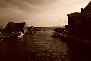
We watched a regatta with several little sailboats and then had a fantastic dinner at the Fishmonger Cafe. Later we retreated to our RV at the Walmart in Falmouth.

Regatta at Woods Hole, MA
On Friday we began our trek toward New York, stopping to have the RV serviced for several hours in Connecticut before we finish off the trip at midnight.

Sunday, August 14, 2011

Southern Vermont...the Green Mountains

West River near Newfane, VT

Waterfall near Townshend, VT
On Tuesday night, we stayed at a Walmart near Concord, NH, and were serenaded by several blaring car stereos playing rap music for most of the night. Awesome. On Wednesday, we headed to the quiet, beautiful area of southern Vermont, specifically the tiny town of Newfane. We landed at a very nice place, Kenolie Village Campground, but not before the GPS led us up a steep gravel street deadending in a gravel pit. Nice. Nonetheless, we made it to the campground (pronounced, appropriately 'cannoli') and set up. It is nestled in the Green Mountains with the West River just across the street...so picturesque, and the folks that run this campground are especially nice! 
From inside Scott Bridge

West River near Newfane, VT
On Wednesday evening, we drove around Townshend (just north of Newfane) and found a little waterfall on the side of the road. Then we found Scott Bridge, the longest wooden span covered bridge in Vermont. It's 277 feet long and was built in 1870. Next we headed to a local shop, Dutton's Farm Stand, and picked up some treats...specifically a Maple Creemee (a soft-serve maple ice cream cone...yum!!!), a couple of giant homemade cookies and some local fruits and veggies. After dinner, we roasted some giant marshmallows...yum yum!


On Thursday, we checked out the Townshend Dam Lake, just north of the little town of Townshend. We played at the beach, got a little sun and watched a couple of kayakers paddling around the lake. In the afternoon, Townshend had a farmer's market on the town square, so we bought some local veggies and some dinner there. We also walked around a little cemetery there. We returned to the campsite in the afternoon and...roasted some more marshmallows, and then headed out to dip our toesies in the West River.
Townshend Dam Lake

On Friday, we took the day off. We just hung around the RV and vegged. We were totally useless. Sweet.

On Saturday, we headed north to Weston, VT, where the Vermont Country Store and Weston Village Store are located. We sampled (cheeses, dips, mustards, meats, crackers, cookies) our way through the Vermont Country Store, then went to the Weston Village Store for lunch. We also managed to take in the Weston Museums, which consist of the Old Mill Museum and the Farrar-Mansur House. We were given a personal tour of the house by the curator's husband and he told us all about each of the rooms. The Farrars raise 13 children in the little house built in 1795 by Captain Oliver Farrar. It was a fascinating tour.
Old Mill Museum, Weston, VT

Weston, Vermont
After Weston, we drove south to Newfane, where the town was hosting a History Fair on the town square. We walked around and took in the historic buildings around the square and visited the Newfane Historical Society museum.

And, of course, we picked up another Maple Creemee at Dutton's...yum!

Tuesday, August 9, 2011

Wolfeboro, New Hampshire via Augusta, Maine

On Saturday, we stayed in Augusta, Maine, and shopped a little, did some laundry, and on Sunday, did a little sight-seeing in the rain...again. The picture-taking opportunities were far worse than in Acadia, so no pictures of Augusta were taken. Augusta does have a clever way of displaying its historical sites and such, through a series of placards placed seasonally around the city, mostly near the historical waterfront. The series is called Museum in the Streets and the portion we saw told of the damming of the Kennebec River for industrial purposes in the 1837 (against an engineer's advice), its destruction by flood in 1839, its rebuilding in 1840, flood damage again in 1855, floods of the city exacerbated by the dam in 1923 and 1936, a spectacular fire that destroyed the mill the dam supported in 1989 and the dam's eventually destruction in 1999 for environmental reasons. Very interesting way of showing the city's history!

When we departed Augusta on Sunday, we drove west toward Conway, New Hampshire, but had a hard time finding somewhere to hang our hat. We drove all the way around the western and southern sides of Lake Winnipesaukee and up the eastern edge to Wolfeboro, an adorable little town with easily the cleanest and quietest (and prettiest) campground Ken and I have ever stayed in...Wolfeboro Campground. It made for a long day of driving, but it was a beautiful ride through picturesque scenery...in the rain.

We ate at a local Chinese restaurant for dinner then roasted some giant marshmallows over our campfire. Yum!

See the rain cloud?!?
On Monday, Ken worked on the RV roof (we've sprung a couple of leaks, now fixed). We left the campground to head into Wolfeboro for lunch at the Wolfeboro Diner, a tiny little restaurant in the heart of the town on Main Street. We walked across the street to rent a kayak from Dive Winnipesaukee and that's when the real fun began. We kayaked out onto the lake under a big dark cloud. We were quite a ways from the dock when it began to sprinkle on us. Then it began to pour. We paddled and paddled but by the time we got out from under the rain cloud, it had rained on us for about 10 minutes straight. HA! We were laughing the whole time...at least it was fun. We zigzagged across the lake for another 2 hours, wearing out our arms, before heading back to the dock.

We then drove over to a little public beach area, Brewster Beach, and took a swim. The water in the lake is so clear and clean we could see our toes in six feet of water. What a nice day!

We had dinner in the RV and then....more marshmallows by the campfire! Woohoo!

Monday, August 8, 2011

Bar Harbor and Mount Desert Island, Maine

Bar Harbor, Maine

On Saturday we drove to Bar Harbor and visited our favorite wooden lobster holding an ice cream cone (we first took pictures with him 5 years ago). We walked down to the actual harbor of Bar Harbor, took some more pictures and wandered aimlessly. The Maine weather has not abated (mostly rain with some clearing at some point during the days), so picture-taking was less than ideal. But what a pretty island anyway! We picked up a snack at the Little Notch Bakery and blueberry ice cream cones at the Rexall Drug Store (so much cheaper than the ice cream shops!!!).

Near Bass Harbor Lighthouse
Next we toured around the rest of Mount Desert Island, where Bar Harbor is but only one of many little adorable towns. We drove through Seawall, Manset, Southwest Harbor, Bass Harbor, Hall Quarry and Somesville.
Bass Harbor Lighthouse

We stopped by the Bass Harbor Head Lighthouse at the southern tip of the island and hiked on a little trail overlooking Bass Harbor and Blue Hill Bay. Again, what a beautiful sight, but such a gray day to visit. Oh well. Check out more pictures of the island at AcadiaMagic.com. I wish we had had such nice weather!

Seawall, Maine
Acadia National Park
On our way back to Ellsworth, we stopped at one of the many, many farmstands in this area selling wild Maine blueberries (argh...we couldn't find them at all the day before!). We had seen a sign earlier in the day at a farmstand selling a quart of blueberries for $3.50, but at the place we stopped, the gentleman wanted $6/quart. Ken told him about the other farmstand and was told "if you can find them that cheap, I'll give you a free quart." Ken (never one to run from a challenge) found the $3.50/quart place (or 2 quarts for $6!), bought the two quarts, returned to the challenger and collected our free quart. Score! Wow, 3 quarts of blueberries for $6...nice.
SCORE!

We celebrated our take with some Sea Dog Blue Paw Wheat Ale, a locally made seasonal blueberry ale that we both highly recommend if you can find it. Yum yum!

Friday, August 5, 2011

Schoodic Scenic Byway by way of the Wild Blueberry Capital of the World

Acadia National Park
Jonesport, Maine
On Friday, we departed from Calais on a mission for wild Maine blueberries and we were told that Washington County (the easternmost county in Maine) is responsible for the growth and harvest of 90% of the world's wild blueberries, most of those coming from around Jonesboro, ME. 

Well, we searched all over and found...nothing. No farm stands, no random neighbors selling berries by the road, no berries in the grocery stores...and yet everywhere we looked were all these expansive blueberry fields! 

The wild blueberries grow on little scrub bushes about 6 inches tall (they look more like ground cover than “bushes”) and the pickers harvest them using a blueberry rake, a tool that looks like a box with long prongs and a handle. The berries are harvested in August, so we thought we'd find them for sale (or for picking) all around. No luck. But beautiful countryside! We headed westward and finally found the only farm stand for miles and bought their very last quart of wild blueberries. Yay!
Bean Island

Next we drove on to Jonesport, a town described to us as existing only because of the lobster industry there, but we found nowhere to actually buy or eat one. I think the Mainers' sense of signage humor is at it again.

Schoodic Point
Schoodic Scenic Byway
Nonetheless, we headed on toward the Schoodic Scenic Byway, a road that skirts the edge of Schoodic Point, a part of the Acadia National Park just east of Bar Harbor. The formation of the Schoodic Peninsula through various glaciers resulted in black dikes through the pink granite you see in the pictures. We were also treated to fantastic views of Frenchman Bay, several small islands and, of course, the Atlantic Ocean. Having taken so many pictures and enjoyed so much beauty, we stopped in to chat with the very friendly folks at the Nautica Pub in Birch Harbor, Maine, and had a snack and a brew. We then watched the sun setting over Frenchman Bay as we made our way back to Ellsworth to settle in for the evening.

Calais, ME via lots of “Down East” Maine coastland


Lubec, Maine
It has been raining through most of Maine, though it has also been sunny every day for at least part of the time. We moved on this morning toward Calais, Maine, and drove through some very small towns (read: a couple of houses and a mechanic...or several shuttered businesses and an excavating company...that kind of thing). Anyway, Calais (or callus, as the locals pronounce it) is a picturesque little town perched on the very edge of the St. Croix river overlooking St. Stephen, New Brunswick, Canada just across the water. We stopped at the visitor's center to get the scoop on some nearby sites and were glad to happen across a group making a traditional birch bark canoe in the style of the Passamaquoddy Tribe using only hand tools. Wow. Looks like a lot of work, but how cool! 

We walked The Ed and Charlie along the a footpath that was formerly a railroad bed right next to the river.

Next we drove south to the 45 degree latitude marker...a red granite stone that says “This Stone Marks Latitude 45 North, Halfway From the Equator To The Pole. – 1896”. Nothing else here but a great little trail leading off into the woods...too bad we didn't have our hiking boots on.

Next we motored on to Lubec, the easternmost city in the U.S., and enjoyed a snack and brew (Black Bear Bluesberry Ale – like a Belgian ale with a hint of blueberry flavor and smell – yum!) at Water Street Tavern and Inn. We walked around the tiny downtown of Lubec, a town just across the entrance of Cobscook Bay from Roosevelt Campobello Int'l Park in Canada. Lubec was decorated in all its finery for their bicentennial celebration.

Reversing Falls Park
On our way back to Calais and the RV, we looked for Reversing Falls Park near Pembroke, a town of only 879 people. Let's just say that Mainers must have a sense of humor with their signage...or complete lack of it. By sheer luck and happenstance, we drove down a very long road, then turned down another, then turned down a very long gravel road, drove some more and then walked down a little dirt path to the edge of the point and finally found Reversing Falls “Park”. Not a sign to be seen until the last turn. (Ha! We found it anyway...better luck next time, Mainers.) The park is so named because of the tidal forces in Cobscook Bay around the two points formed near Leighton Neck. The tide comes in at such a force that the water rushes inland over rocks and jetties and fills the bay. At low tide, the water rushes out just as quickly and whirlpools, mini geysers and large waves form in the opposite direction. The tide changes by 8 meters here every six hours! Very cool!

With so much sight-seeing, we were forced to detour for blueberry ice cream cones at the Polar Treat, a little ice cream stand just east of absolutely nothing. It's interesting and a little surprising how remote this area really is. There are just beautiful views and lots of pine and birch trees and not much else. Gorgeous part of the state...for sure.

Lastly, Ken pulled off at a lookout point for Whitlocks Mill Lighthouse, though the light was fading too fast for us to walk over to it. We watched the sun set over the St. Croix River and Passamaquoddy Bay from this little lookout...wow. What a great day!

Thursday, August 4, 2011

Central Vermont

After leaving the bustling town of Herkimer, NY, we drove straight across what remained of New York State and in to Vermont. We settled into a campground we had stayed in five years ago -- Onion River Campground, in Marshfield, VT, nestled on the bank of the Winooski River. We checked out the area and on Tuesday we met up with the parents in Stowe, VTFirst, the four of us toured the Ben and Jerry's Ice Cream Factory in Waterbury, VT. What fun! We had lots of ice cream samples...yum!! Ken and I walked up to the Flavor Graveyard where all the "dearly de-pinted" flavors are buried. Ha!

Nearby, is the Von Trapp Family Lodge, above Stowe overlooking the Green Mountains. The von Trapps are the family that escaped Austria in the movie, the Sound of Music. They settled in Vermont because the state reminded them of Salzburg, Austria. Gorgeous resort!

Later on Tuesday, we toured the Cabot Cheese Creamery in Cabot, VT. I highly recommend this tour...the young lady giving the tour was extremely informative about their cheese-making process and about the Cabot farmers' cooperative. We came away stuffed with cheese samples and some goodies for the rest of the trip. Yum!!

After so much ice cream and cheese, the four of us convened at our RV for some drinks and then headed to dinner at an Irish pub in Montpelier, VT. Montpelier is a pretty little town...very little, in fact, for being the capital of a state.

Vermont is a beautiful state, perhaps the most diversely beautiful state we've so far visited. This time of year promises lots of wildflowers along the highway, stunning mountain vistas and crisp, clean air. I only wish the pictures had captured what we were actually seeing. There are hundreds of little streams and rivers and creeks meandering through the countryside...so pretty, but so far no luck finding anywhere to go tubing!!!